The rugged Montana 750i handheld combines the flexibility of on- or off-road navigation with global messaging and interactive SOS via inReach satellite technology1 — plus a built-in 8-megapixel camera.
- Big news. A full QWERTY keyboard lets you easily type messages.
- Wander wider and still stay in touch — with inReach for messaging and 24/7 SOS.
- Nav, meet cam. Put your trip pics on the map with geotags.
- Routable TopoActive Australia and New Zealand maps. Now you’re free to take it off-road or on.
- Meets MIL-STD 810 for thermal, shock, water and vibration.
- Power your adventures with 18+ hours of lithium-ion battery life in GPS mode.
- Exchange text messages with loved ones, post to social media, or communicate via inReach device to inReach device in the field (active satellite subscription required).
- In case of emergency, trigger an interactive SOS message to GEOS, a professional 24/7 global monitoring and response center (active satellite subscription required).
- Instead of relying on cellphone coverage, now your messages, SOS and tracking are transferred via the 100% global Iridium® satellite network (active satellite subscription required).
- Available inReach weather forecast service provides detailed updates directly to your Montana handheld or paired devices, so you’ll know what to expect en route.
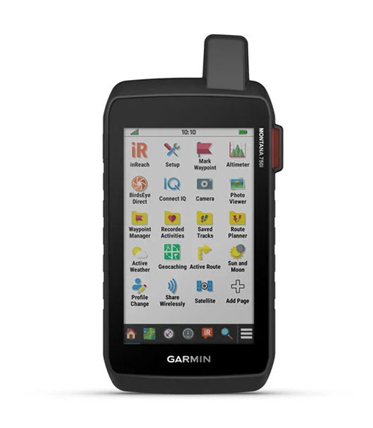
- This durable, water-resistant handheld is tested to U.S. military standards and features a glove-friendly 5” touchscreen that’s 50% larger than previous Montana models.
- Capture images of your exploits with Montana’s digital 8-megapixel camera. It geotags photos with coordinates, so you can navigate back to favourite sites in the future.
- Seamlessly transition from trails to road navigation with preloaded City Navigator street mapping, which guides your drive with easy-to-follow turn-by-turn directions.
- To navigate your adventures, use preloaded TopoActive Australia and New Zealand maps. View elevations, coastlines, rivers, landmarks and more.
- Use direct-to-device downloads of BirdsEye Satellite Imagery (no annual subscription required) to see photo-realistic views and create waypoints based on landmarks.
- Navigate your next trail with ABC sensors, including an altimeter for elevation data, barometer to monitor weather and 3-axis electronic compass.
- Use cellular connectivity2 to access up-to-date Active Weather forecasts through the Garmin Connect™ app.
- For hunters and trainers, this Montana syncs with compatible Astro® or Alpha® series handhelds (sold separately) to help track sporting dogs in the field.
- Access to GPS, GLONASS and GALILEO satellite networks enables Montana® 750i to track in more challenging environments than GPS alone.
- Track your location, and share it with those at home or out in the field. They´ll be able to see your progress or ping your device for your GPS location and more via your web-based MapShare™ trip-sharing page. (Montana 700i, 750i only – satellite subscription required).
- Trek far and wide off-grid. Use Expedition mode, an ultralow-power GPS reference, to keep Montana tracking for a week or more between recharges.
- An internal, rechargeable lithium-ion battery pack provides more than 18 hours of battery life in GPS mode.
- A variety of Montana handheld-compatible mounts (sold separately) lets you adapt your navigator for use on ATVs, boats, cars, motorcycles, RVs or other vehicles.